
Respecting Mother Nature! Ep. 17
Do you know what a five day cone is? For those kiddos who might be reading this, it is the National Hurricane Center’s visual product which represents the most likely path a currently active named storm will take over the next five days. The cone shape comes from the increased margin of error which naturally occurs as you predict further into the future.
Anyway, we have been living by the cone! There is a web site that we check at least twice a day to make sure there are no surprises in our future with the predicted route of “Florence”. For all you power boaters out there, it is important to remember that our max speed is between 6 and 8 knots, so getting out of the way of the storm takes us a while! We will experience higher than normal seas and strong winds as a result of Florence passing off-shore so when we will be the most affected, we plan to stay put for a few days. The anticipation is a bit unnerving! We typically use NOAA for the latest status.
The Pig Who Helped the Man Ep. 16
(A fictional story by Zachary. The assignment was to write a story about an animal that helped a man.)
Janyang swept across the plains of North America, the foothills of the Rockies on his left, and the endless plains stretching far to his right, stretching out of sight. With his spear pointed forward, he slowed when he heard a herd of pigs approaching. The herd turned away when they saw him, but one of the curious younger ones continued on, and brushed against Janyang’s legs, before trotting back toward it’s herd. However, the young rogue had human scent on him now, and when he came to the other pigs, they snarled and kicked him away. Janyang had crept along behind the rogue, and now he intervened, protecting the poor little pig with his spear. The other pigs paused, and, after a moment’s hesitation, trotted away. As it was getting near dinner, he decided not to give chase, and turned toward the hills. He walked in that direction for a while, his tribe’s camp being under and around a rocky outcropping. Lost in thought about the strange pig’s behavior, he did not hear the threatening rattle of the coiled rattlesnake lying on the ground. He was only aware of it’s presence when it had jumped and was rearing up at him. He stopped and stared, terrified, at the snake about to bite him. He knew it was already over. He shouted, but to no avail. It was now a foot from his bare leg, when suddenly it had fallen to the ground, and was writhing in agony. Janyang looked and saw that the rogue pig had bitten it and killed it without fear. Janyang realized that it had a resistance to snake venom. From then on, Janyang and Mathnea (which means ‘deserter’) would always be together, Mathmea protecting Janyang while Janyang hunted and fed him. It was an advantageous relationship for both of them.
The End.
Whale, Ho! Ep. 15
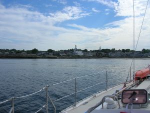
We left our friends, the Skillins, in Kennebunk this week and started making our way further south. There was a general willingness amongst the crew to continue our march south at a rapid pace in hopes of warmer weather. On Tuesday, we motored for 45 miles to Rockport, on the tip of Cape Ann, near Gloucester. Rockport is a quaint small town with an enjoyable waterfront area called Bear Skin Neck. Back in the War of 1812, this spot was the site of Seafencibles, a reference to men that were posted in forts to protect the harbor. They were overrun by the British in a surprise attack and taken prisoner. Fortunately, we faired better, as we sampled the goods from the local ice cream shop! It seemed like this spot would be teeming with visitors in the height of summer; now that school has started, we get to enjoy these areas with a bit more elbow room on the streets. Here’s a picture of the waterfront area as we approached to anchor.
I got a lot of criticize from the family for taking many pictures of Thalia from the shoreline… why is it that some sailors, once off the ship and wandering ashore, focus instead on the ship from whence they come?!
Continue reading “Whale, Ho! Ep. 15”Chart – Rockport, MA to Plymouth, MA
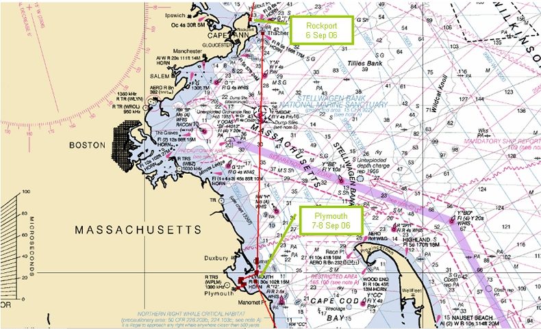
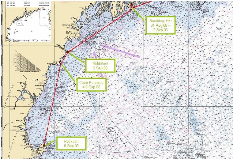
Chart – Boothbay Harbor, ME to Rockport, MA
Birthdays, Books and “Bbbbrrrrrs” in the Mornings! Ep. 14
Birthdays ~
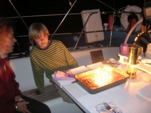
Late August is always accompanied by cake and candles for both our youngest and I and this year was no different. Ok, a little different ~ see, I don’t have my good stoneware baking pans … or, more accurately, they don’t fit in the boat’s oven! So, we all got pretty good at cutting off the slightly burned cake bottom while maintaining the icing position above! One never knows when THAT skill will be needed again!
Here is our youngest in front of their cake in the cockpit of our boat!
Continue reading “Birthdays, Books and “Bbbbrrrrrs” in the Mornings! Ep. 14″
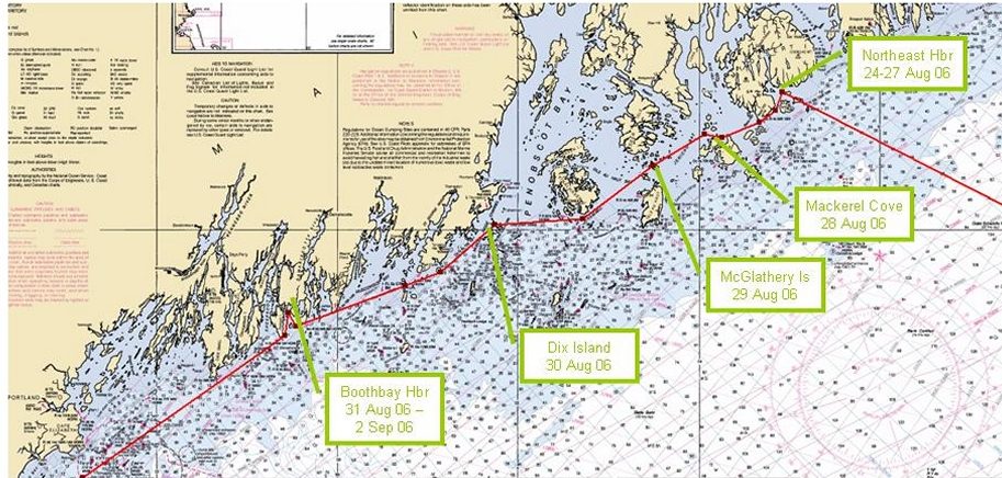
Chart – Northeast Harbor to Boothbay Harbor, ME
The Wallet I Lost a Week Ago and Found Today Ep. 13
(A poem by our youngest)
I lost a wallet blue and sleek
Dreaded I lost it for a week.
I found it in my pants in my shorts pile
Luckily it’s not down the Nile!

Difference Between Houses and Boats Ep. 12
By the youngest member of the Thalia Crew!
There are lots of differences between living in a house and living on a boat. A boat is always moving because of the wind, water currents and ocean swells. All of the rooms in a boat are smaller. In fact, my room, my bathroom and by brother’s room would fit three times in my bedroom at home. Another big difference is how we get electricity. We buy it at home and we generate it on our boat by running our engine. The last big difference is water. We carry it with us all the time in four tanks. We have to be very careful about not to use too much. My favorite difference is that we can travel in our home.