
Having filled our brains with old shipbuilding history for one more day at Shelburne, and after I paid a visit to the local tavern that had a wi-fi hotspot, and ‘suffered’ through a pint of local brew while doing emails, we cast our lines from the government wharf early the next morning at 5am to gain the favorable current out the harbor. Getting up at that hour should have made both Karen and I morning people. The kids were still asleep, the water was glassy calm, and we each enjoyed a warm beverage as we motored slowly down the harbor and into the ocean, just in time to see the orange ball of the sun peak over the horizon — it’s an experience to behold!

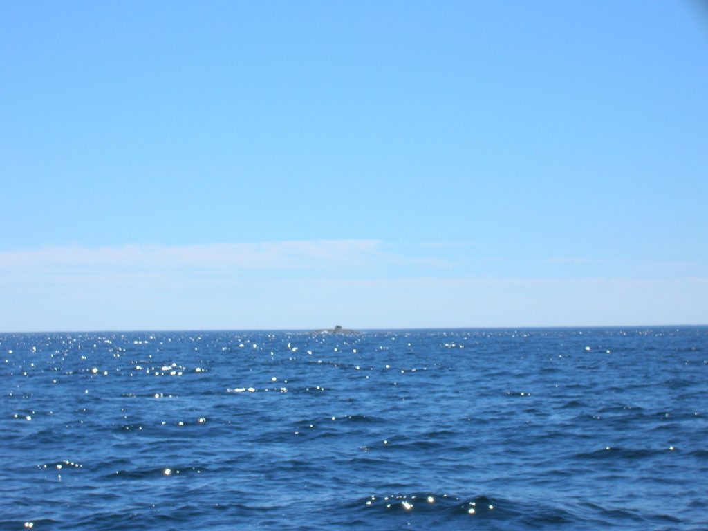
For all of you folks south of us, in the midst of a nationwide heat wave, you might consider the coast of Nova Scotia… after leaving Shelburne, we weren’t too sure of a destination, but suffice it to say that we wanted to find someplace warm. The below photo is what we have become accustomed to when we have been underway in the early morning!
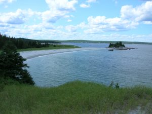
Not long after the above photo was taken, we were pushing northeast along the coast a few miles offshore. On the chartplotter ahead was a very small island, more like a rock, labelled ‘Little Hope Island’, not far from ‘Big Hope Island’. Our track on the chartplotter took us just inside of Little Hope, over a ledge that made out from the island with depths starting at a few feet and gradually deepening to 20-30 feet. Being lazy and not wanting to lay out a new course on the chartplotter, I decided to watch the depth carefully and make adjustments as needed. I was not worried because Little Hope would be easy to identify as it had a 100 ft high lighthouse on it… or did it? Here’s a photo, and I know it is hard to make out as we were trying to give it a lot of searoom, but do you see any 100ft tall lighthouses?
If I tell you that the land on this island was no more then 100′ long, does that help?! As we got closer to the island, my heart started racing. Were we really seeing Little Hope Island or some other rocking outcropping and therefore where were we? On the chartplotter, we were passing Little Hope, but where was the lighthouse? As I passed what was supposed to be the shallow ledge, Karen peered through the binoculars and identified the ‘bump’ on the island as not the remnants of a washed away lighthouse but rather a fishing boat, high and dry, long since abandoned! My heart was in overdrive now! Apparently we weren’t the only ones thrown off by this confusing island. Well, we ended up passing safely around the island, and we joked afterwards about how this island was indeed hopeless! We also had a renewed sense of caution about the accuracy of our electronic charts.
With a reduced heart rate and a rising breeze, we changed to our larger genoa and were zipping along at 7 knots to Port Mouton. The guide said that we could find white sandy beaches reminiscent of Cape Cod, complete with tall waving grasses on the dunes. For once this guy was right! After traveling 45nm, we dropped the hook off of such a beach mid afternoon on Sunday and wasted no time dinghying over to the beach.
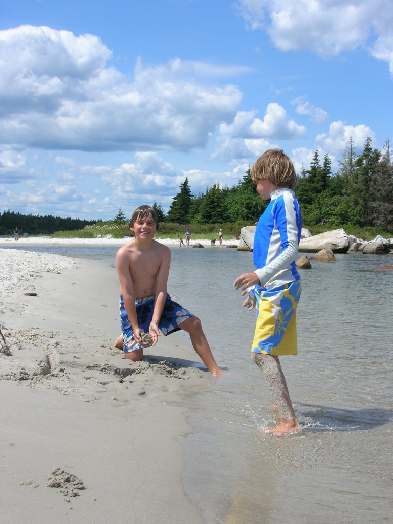
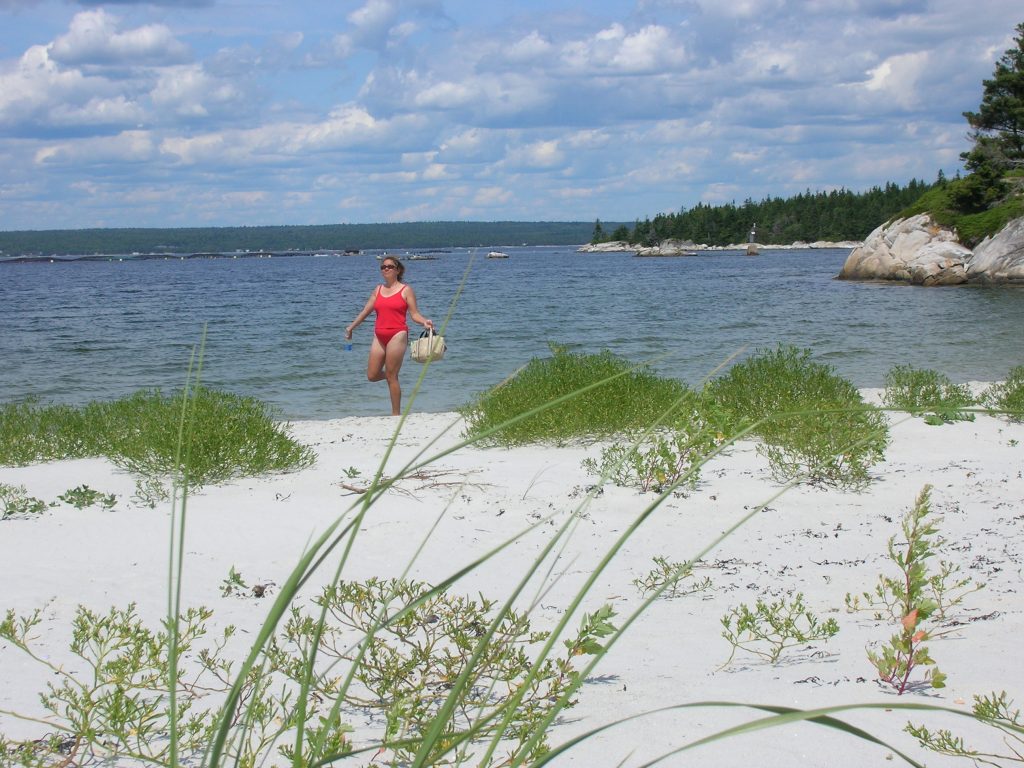
This proved to be the most splendid spot we had found thus far in Canada. It was quickly approved by all members of the family as a ‘two-dayer’, with the second day spent almost entirely at the beach. Karen and I joked about what our non-boating friends think of the cruising life — with many days basking in the sun with ice-cold beverages at the ready — vs. what it really is — seemingly continual work. Finally, we were living a day for those friends! We ran out of different ways to say ‘Man, is this a great spot!’ Here’s another photo…
But, like all good things, our playtime had to come to an end. We left Port Mouton on Tuesday for another glorious 5:30am departure into the sunrise. Our objective was another 45nm jaunt to Lunenberg. This town came highly recommended from every guidebook and tourist brochure we could find. Like Shelburne, Lunenburg was supposed to be a quaint seagoing town steeped in the old shipbuilding history of Nova Scotia. There was one problem though. Our Garmin gps/chartplotter had no detailed charts of the Lunenberg area. I had bought an unlock code for Garmin’s Nova Scotia chart region up to Halifax, but oddly enough they were missing a detailed chart of the Lunenberg harbor and it’s nearby coastal entrance. And, we had no paper charts of this area! If they could mislabel Little Hope Island, maybe their charts couldn’t be worth much, but I felt very handicapped with no charts at all, for a destination that was supposed to be one of the top places to visit on the Nova Scotia coast! We ended up combing through the Canadian ‘Sailing Directions’ book (similar to the U.S Coast Pilots) which described buoy lat/lon’s and compass headings to enter the harbor, and we felt our way in slowly under power.
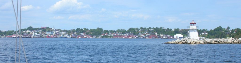
What a charming town Lunenberg was! It is a bit hard to pick out on this photo, but the town has a beautiful waterfront, with bright red, blue, white and brown houses stepping down the hillside to the water. It reminded me of Camden, ME with it’s nautical charm. Like Camden, it also had it’s share of tourists and tourist-oriented shops and harbor tours. But we also took in a wonderful museum here, the Fisheries Museum of the North Atlantic.
We also paid a visit to the local marine store to buy the charts for the Lunenberg area. What a pleasure it was to look over the area you had somewhat blindly navigated through! No longer would we be stuck without nautical charts! On our departure from Lunenberg on Thursday, I gave the kids a quick lesson in paper chart navigating using parallel rulers and dividers. Our youngest figured out compass courses and distances and called them over to Karen to follow — who needs those expensive, finicky electronics anyway?!

By the way, to all of you powerboaters out there, if you ever come to Nova Scotia, make sure you have alot of fuel capacity. The concept of a fuel dock here is a real novelty! We filled up the last time in Southwest Harbor before leaving for Canada, and we’re down to half of a tank in Shelburne. I had been keeping an eye out for fuel for the last several days, but either the towns had nothing or the fuel dock written up in the guide was now shut down. We luckily found Lunenberg Yacht Club, with diesel at the bargain price of US$5/gallon! We felt happy to find a dock as the other option that we were given was to call for a fuel truck delivery and face a 200 liter minimum.
With fuel and water topped off, we motored on to Mahone Bay where we would find the Mahone Bay Classic Boat Festival starting. We dropped anchor in the company of at least 100 other boats, and witnessed our first major equipment failure. Karen was just finishing up letting out the necessary 80 feet of chain and suddenly the anchor windlass stopped working. It wouldn’t lower or raise the chain. Our youngest and I spent the afternoon disassembling it’s motor, cleaned it up thoroughly and found it ran fine… for about 1 minute more then stopped. It sounded like the gear mechanism was jammed. This was a windlass that had seen it’s day — the paint was chipping off and it would frequently strain under moderate loads. I didn’t have alot of confidence in it’s longevity, and now the truth was out. It was dead and was not going to come back. Today, Friday, was full of rain and most of the festival’s activities were rained out, so I had ample time to research new windlasses. Getting a new one would not have been a problem if we had been state-side, but getting one shipped into Canada was going to be expensive, plus their 14% sales tax is tough for us New Hampshirites to get used to! We also needed to find someone trustworthy enough to accept and hold on to a $2000 item. We can still use the old windlass in manual mode with a handle, so our current thinking is to have one shipped to our first returning port in Maine and deal with the inconvenience until then.
That is all for this week… we hope all is well with you, our website brethren!