The tides along the Brittany coast, especially as you get closer to Normandy, are some of the largest in the world. During a full moon at St Malo, for instance, the tide range can reach 15 meters, nearly 40 feet, or higher than a 3 story building. Not only does it require very careful planning when you are entering or leaving a harbor, or anchoring for the night, but that volume of water is flowing in and out twice a day, producing ocean currents that at their peak we could not motor or sail against. Anchoring is a real challenge. We normally set out a ‘scope’, or length of chain relative to the depth, of 4:1. In 10 meters of water, we would set out 40 meters of chain. But if the tide range adds another 10 meters of depth, we would have to put out a total of 80 meters of chain (which by the way we don’t have!), increasing our swing radius and risk of collision with other boats or the shoreline. It leads to all sorts of strange adaptations, including marinas with a lock, similar to a lock on a canal, that closes its gate to hold the high water in, and only opens for brief periods each side of high tide. Other marinas will have a large wall with a cutout to pass through, a ‘sill’, that holds back the water at low tide. You can only cross the sill at higher tides, and only after examining the height gauge on the wall or on a digital display. The inside of the marina is usually dredged to a depth to accommodate most boats, but you only leave when the tide comes in enough for you to pass safely back over the sill. If you push it and hit the sill with your keel, causing cracks in the wall leading to drainage of the pool, the damage from all the grounded boats inside would require a fast call to your lawyer to claim personal bankruptcy!
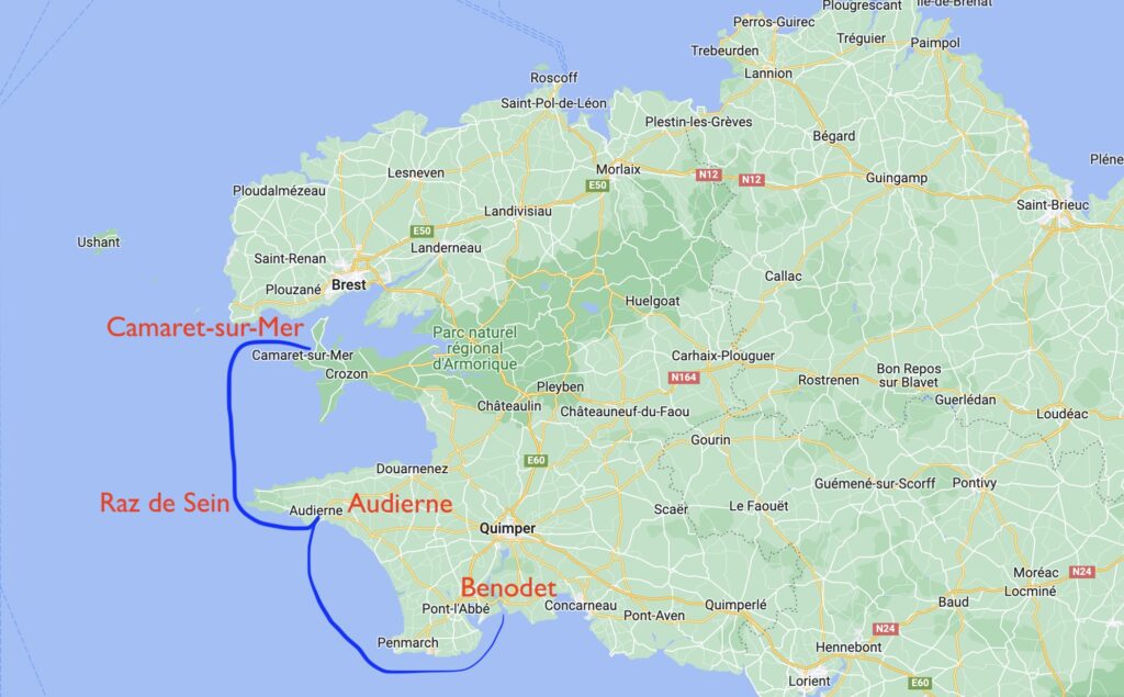
On the ocean current front, we had already started to notice larger tidal currents along the Brittany coastline since we left Belle Isle. With the jagged geography of Brittany’s peninsulas, one finds accelerated currents as the water gets squeezes as it rushes around these points into and out of the narrower English Channel. As we pulled away from the Odet River, we pointed Sea Rose’s bow towards the first of these ‘acceleration zones’, the Raz de Sein, or ‘The Race at Sein’ (a point of land in the area). The pilot book was rife with warnings to transit the Raz at slack water – the time of greatest calm while the current is changing direction – and to make sure that slack was followed by favorable current in your planned direction. We chose to aim for the small seaside town of Audierne first, just before the Raz, for our overnight in order to get the timing right the next day.


